Most Recent TAPs
Explore our recent panel reports below to learn about the challenging land use and real estate issues that ULI members have helped to solve.
Upcoming Panels:
Blue Line Corridor TAP: March 7 – 8, 2024
Bostwick House TAP: April 17 – 18, 2024
Clermont Exchange TAP: May 15-16, 2024

Kennedy Center/Foggy Bottom TAP
The DC Office of Planning and the National Capital Planning Commission partnered to sponsor a 2-day Technical Assistance Panel with ULI Washington on the Kennedy Center and Foggy Bottom. The Panel examined the area covered by sprawling I-66 highway infrastructure between the National Mall, the Kennedy Center, and the Foggy Bottom neighborhood. To address the disruption in the area’s urban fabric and mobility network caused by the maze of ramps and tunnels, the panel was tasked with developing an action plan to restore the street grid, create infill development opportunities, and integrate the Kennedy Center into the city’s monumental core.
Many prior planning efforts had identified the different design and development approaches needed to provide appropriate connectivity to the different parts of the study area. The southern part of the site near the National Mall, the central part of the site stretching from the Kennedy Center eastward to E street, and the northern part of the site by Foggy Bottom all vary significantly in political context and abundance of opportunities for cultural impact, equitable development, and public and private stewardship. The panelists identified short-, medium-, and long-term action items to bring cultural vibrancy, meaning, and a sense of place to each of the three parts of the study area, as well as a framework for implementation of a new vision for the area from a perspective of governance.

Town of Kensington TAP
The Town of Kensington convened a 2-day Technical Assistance Panel to study the proposed Summit Avenue Extension project and associated development opportunities/challenges.
One of the main goals of the 2012 Kensington Sector Plan was the creation of a Town Center by diverting traffic flows via the Summit Avenue Extension project. Projected to be completed in FY32, the Summit Avenue Extension project would extend Summit Avenue past its current terminus at Plyers Mill Road, and connect Summit Avenue to Connecticut Avenue, via Farragut Avenue.
The project was proposed for its potential traffic alleviation, but could also create opportunities for developable frontage, along with multimodal infrastructure. However, the project also creates new challenges, mostly pertaining to pedestrian and bicycle safety, as the new Summit Avenue terminus at Connecticut Avenue, near the University Boulevard split, presents challenges for pedestrian movement and safety.
The Panel cautioned against using the extended Summit Avenue as a traffic mitigation strategy, and instead proposed using the new road as a residential bridge between the historically Black Ken-Gar community and the Town of Kensington. In addition, the Panel recommended the Town consider co-location of uses at the current (or future) site of the Kensington Fire Station.

Prince George’s County Housing Strategy
The Prince George’s County Planning Department convened a 2-day Technical Assistance Panel to evaluate the current housing strategy in the County, with specific focus on two current policies: the rent stabilization and townhouse moratorium bills.
The panel was asked to identify the best tools for managing residential real estate development in (1) achieve the goals of Plan 2035; (2) support a robust and diverse residential housing market; and (3) generally support the county’s economic vitality. ULI is asked to assess the likelihood that Plan 2035’s goal of achieving specified amounts of residential development in identified urban centers can be achieved, and to identify tools that will successfully direct more growth to urban centers.

Grant Building TAP
President Lincoln’s Cottage and the National Trust for Historic Preservation convened a 2-day Technical Assistance Panel to investigate future uses for the historic Grant Building, situated next to the Cottage’s Visitor Education Center.
The Grant Building is situated on the grounds of the Armed Forces Retirement Home (AFRH), was originally built as a mess hall and dormitory for the 400 some armed forces who lived on the grounds. The building stopped being used as a dormitory in the 1960s and has been closed since 1998. Today, the Grant building has serious safety concerns: water damage, asbestos, lead paint. The panel explored the financial reality of mothballing the building, and razing the building, but ultimately recommended rehabbing Grant and reusing it as affordable housing for veterans.

University Boulevard TAP
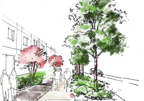
The Montgomery County Department of Planning convened a two-day Technical Assistance Panel with the overall goal of addressing community needs as they pertain to traffic safety, regional connectivity, environmental sustainability, and economic development. The panel was asked to explore potential opportunities for new infill development, bikeways, future bus rapid transit (BRT), and the potential for creating a “complete street” – a boulevard with wider sidewalks, comfortable public transportation stops and safe access. These goals are in line with the Thrive Montgomery 2050 plan, which envisions how the entire county can focus on growth, development, safety and resilience for the coming decades – particularly in the east county, where the University Boulevard corridor is located – while still keeping the agriculture reserve and parklands intact.
University Boulevard TAP Presentation
