Top Story
2019 ULI Washington Pathways to Inclusion Application is Now Open
The Pathways to Inclusion Initiative will provide up to 25 people of color a scholarship to the 2019 Fall Meeting to be held in Washington..
August 6, 2019
Transforming the Virtual Circle to Reconnect the Neighborhoods
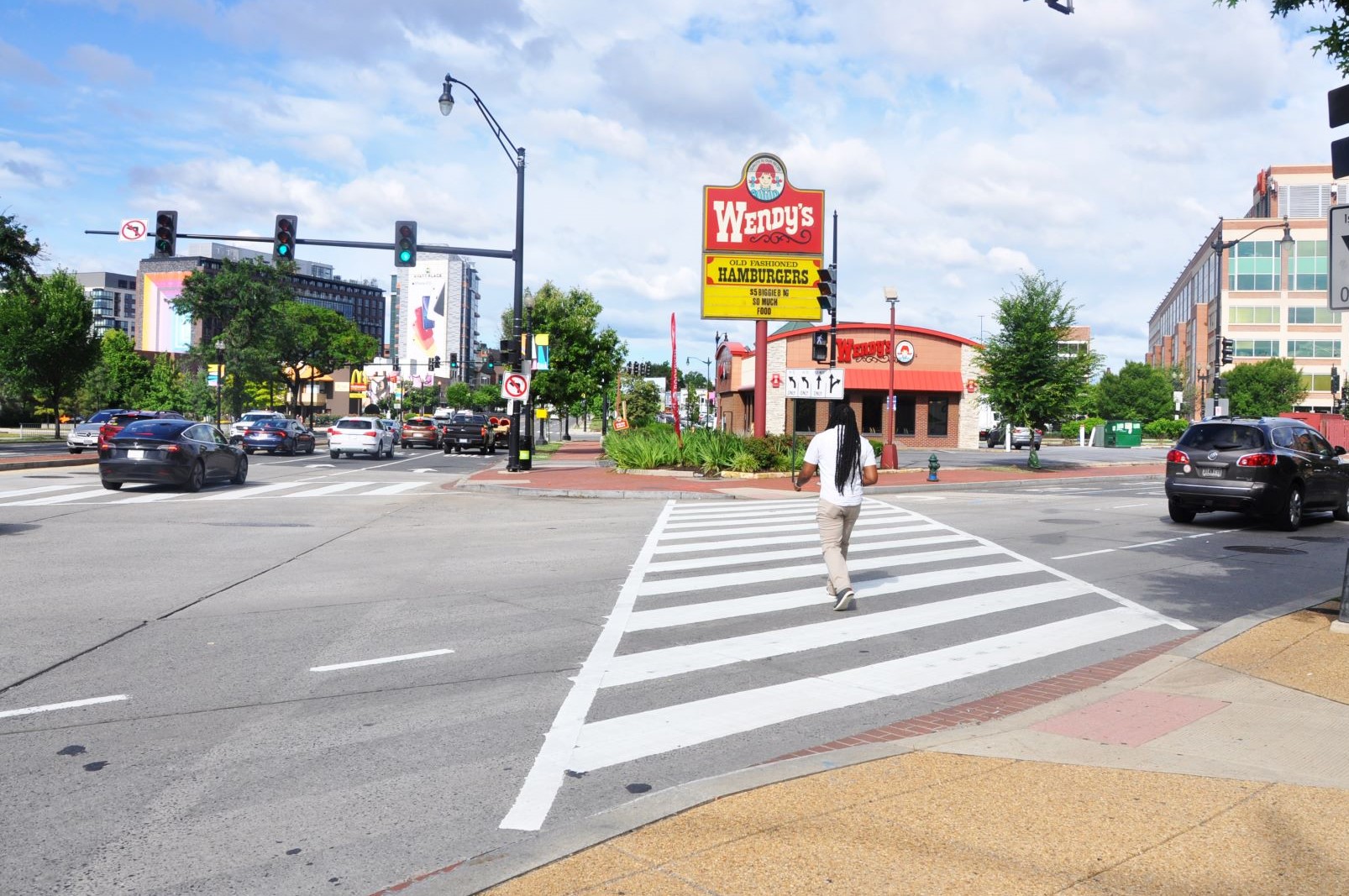
Photo showing the Virtual Circle intersection with the Wendy’s site at the center.
Image source: ULI Washington.
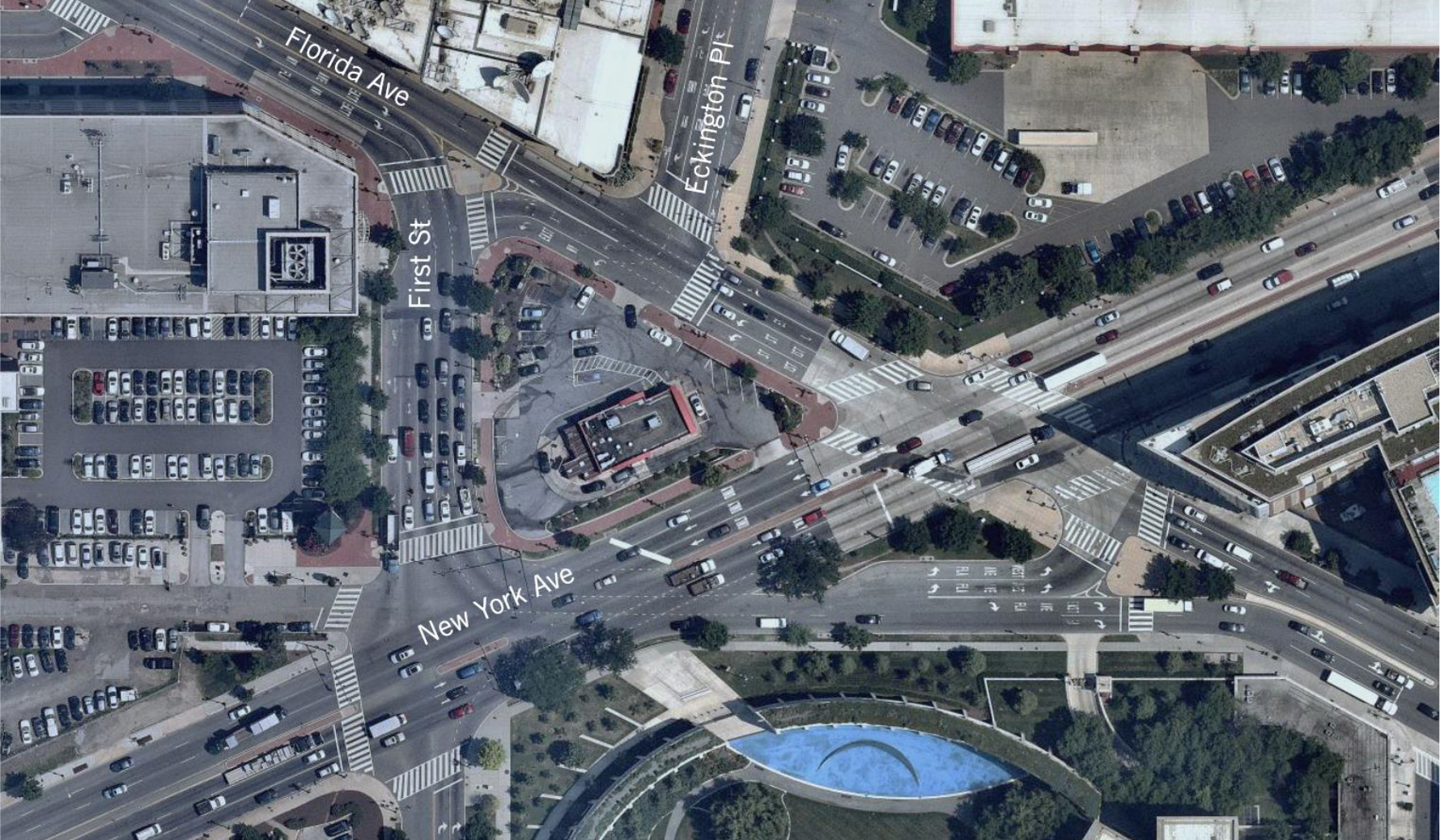
Photo showing an aerial map of existing conditions in the study area.
Image source: Sponsor briefing materials.
ULI Washington recently released a Technical Assistance Panel report documenting existing challenges and recommendations for the future of the Virtual Circle in Washington D.C. The Virtual Circle is located in Northeast Washington D.C., one block east of North Capitol Street NE at the intersection of New York Avenue NE and Florida Avenue NE.
The Technical Assistance Panel, or TAP, was jointly sponsored by the NoMa Business Improvement District (NoMa BID) and the NoMa Parks Foundation. The TAP’s goal was to make recommendations for open space, safety and improvements at the Virtual Circle based on District of Columbia Department of Transportation’s (DDOT) “Concept 6”, which was one out of six options DDOT created during a study in 2013. The FY20 District of Columbia budget includes $35 million for improvements to this circle.

Image showing Virtual Circle Concept 6.
Image source: Sponsor briefing materials.
New York Avenue is also U.S. Route 50, part of the U.S. highway system. It carries over 50,000 vehicles per day. Florida Avenue was originally known as Boundary Street, the northern boundary of the L’Enfant planned city and carries over 20,000 vehicles per day. Eckington Place NE and First Street NE provide north-south connectivity into the Virtual Circle and each carries about 10,000 vehicles per day. The Virtual Circle contains five intersections including the following streets – New York Avenue NE, Florida Avenue NE, First Street NE, Eckington Place NE, and O Street NE. It is a virtually indecipherable tangle that (mis)manages traffic from the two major arterials, New York Avenue NE and Florida Avenue NE, and other contributing roads. Significantly, despite receiving cars, pedestrians, and bicycles from all of these important roads, the Virtual Circle includes only 13 pedestrian crosswalks and no bicycle facilities. At the center of this site stands a Wendy’s fast food restaurant, whose placement has earned the Virtual Circle its other nickname, “Dave Thomas Circle.”
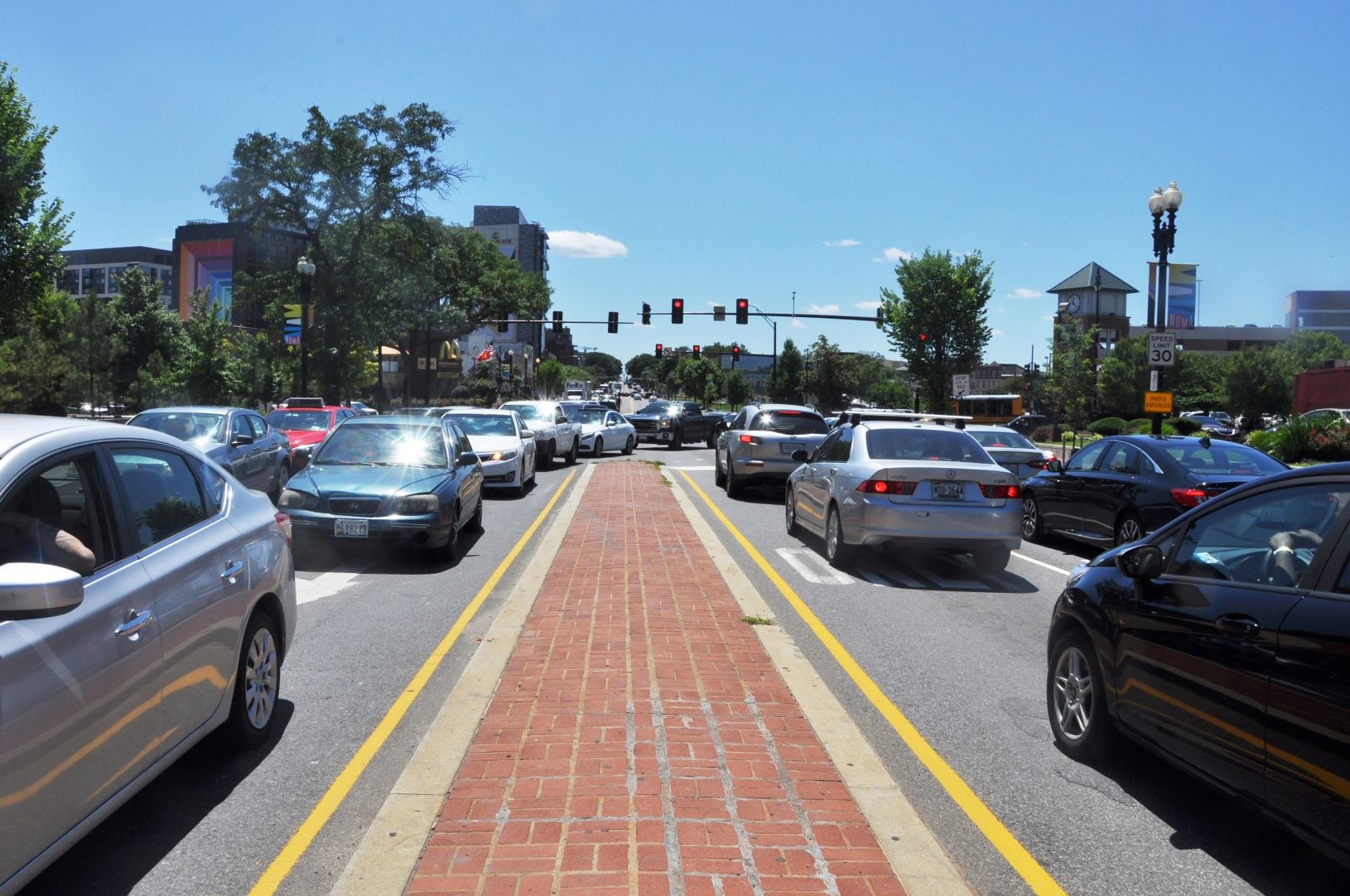
Photo showing regional traffic passing through New York Avenue NE, looking east.
Image source: ULI Washington.
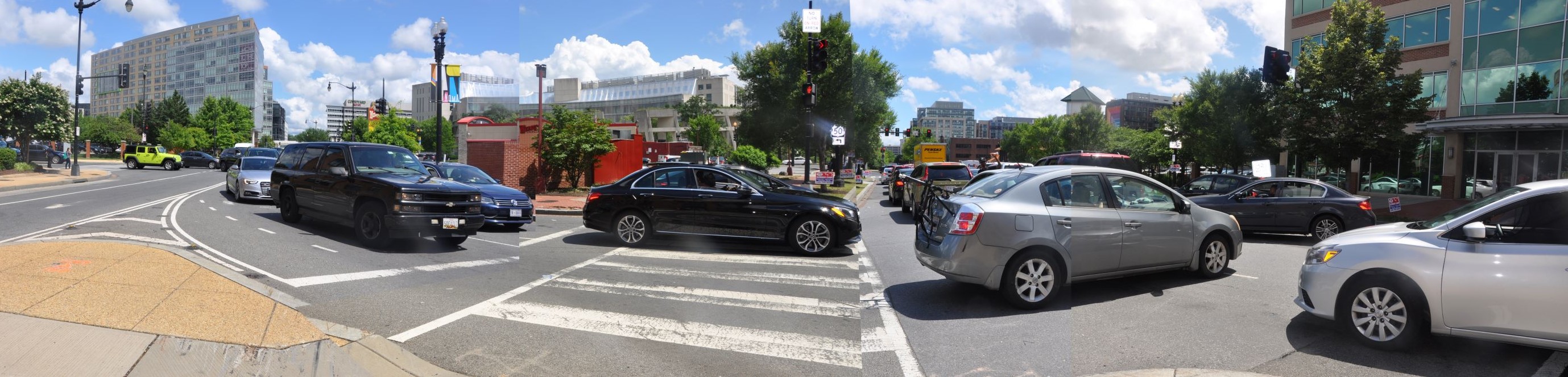
Photo showing traffic along First Street NE and New York Avenue NE at the Virtual Circle.
Image source: ULI Washington.
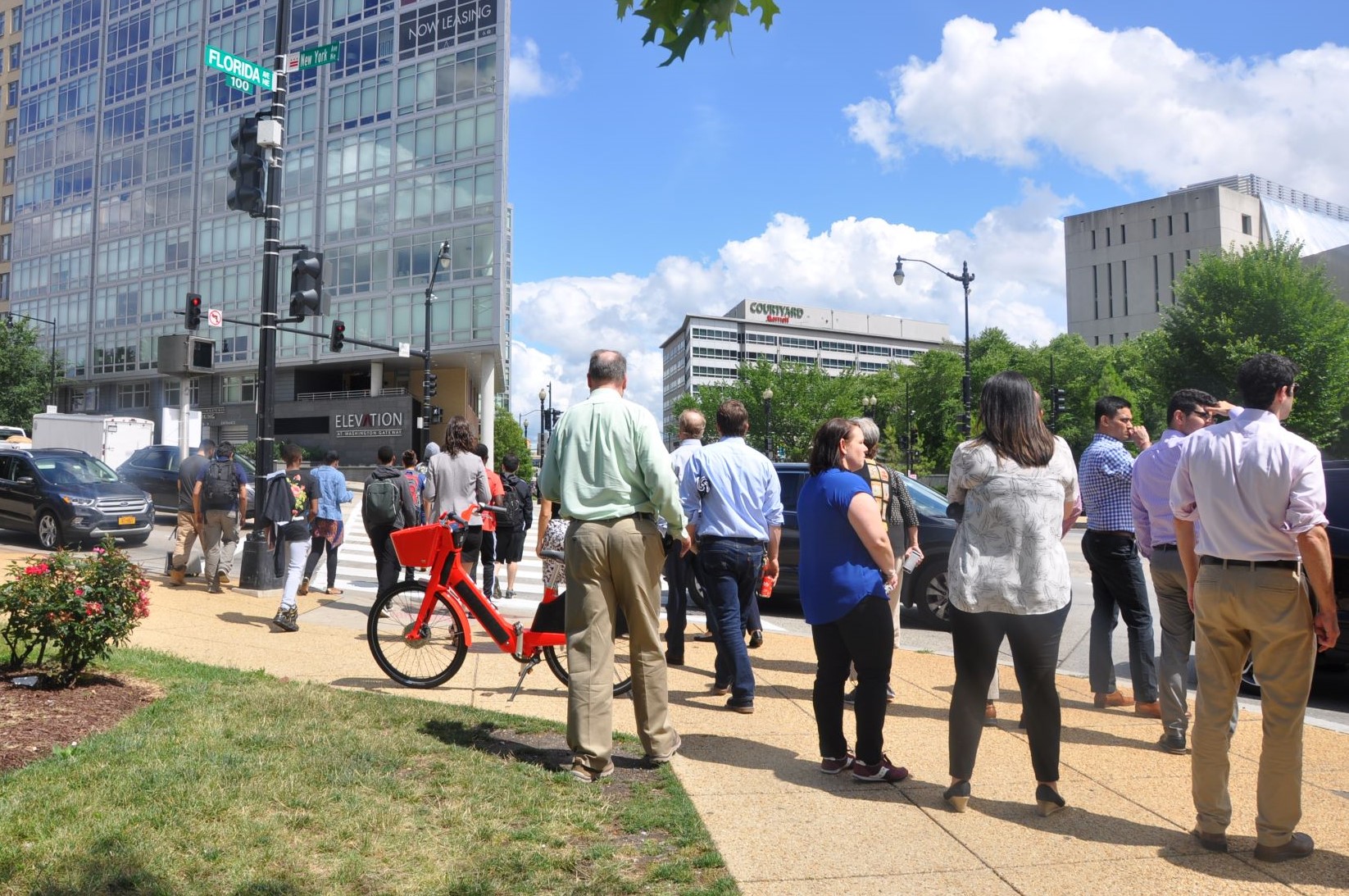
Photo showing multimodal user groups at the intersection of New York Avenue NE and Florida Avenue NE.
Image source: ULI Washington.
Technical Assistance Panels, or TAPs, provide expert, multidisciplinary advice to public agencies and private sector clients facing complex land use and real estate issues in the Metropolitan Washington Region. Over the course of two days, a team of ten ULI members endeavored to understand the existing challenges at the Virtual Circle. The results of this Technical Assistance Panel (TAP) are intended to assist the NoMa BID and NoMa Parks Foundation in the following ways:
At the outset of the TAP, Panelists pointed out that for generations the Virtual Circle intersection has been about moving traffic, primarily in the east-west direction. It has been about getting through the intersection efficiently and as safely as possible. Over time, things have changed considerably. Though moving traffic is still an ongoing major concern, vibrancy of surrounding neighborhoods is evidence that other priorities are emerging. The Panel set out to reconcile these in a way that accommodates some new ideas. Before brainstorming solutions, they laid out some basic goals – to prioritize non-motorized modes of transportation focusing on cyclists and pedestrians, to maximize economic opportunities for existing as well as future businesses and residents in the neighborhoods, to allow for adaptation and continued evolution of the neighborhood with respect to new technologies, patterns of behavior and lifestyle changes that may occur in the future. Due to tragic fatalities, lack of safety has elevated the intersection design issue to the forefront. The TAP is timely, as there is a sense of urgency to arrive at a better solution; and the opportunity is right now – to take action and innovate. The Panel enumerated seven framing principles and values to guide the design process:
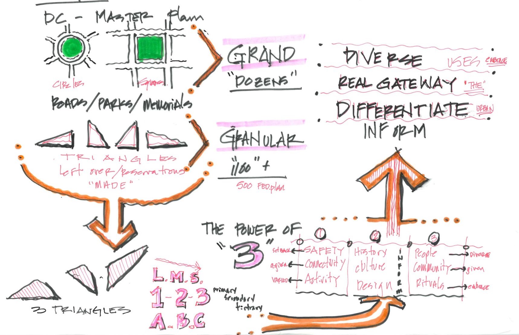
Sketch diagram showing analysis of elements of the L’Enfant Plan of Washington D.C. and the interpretation of triangles within the study area.
Image source: ULI Washington.
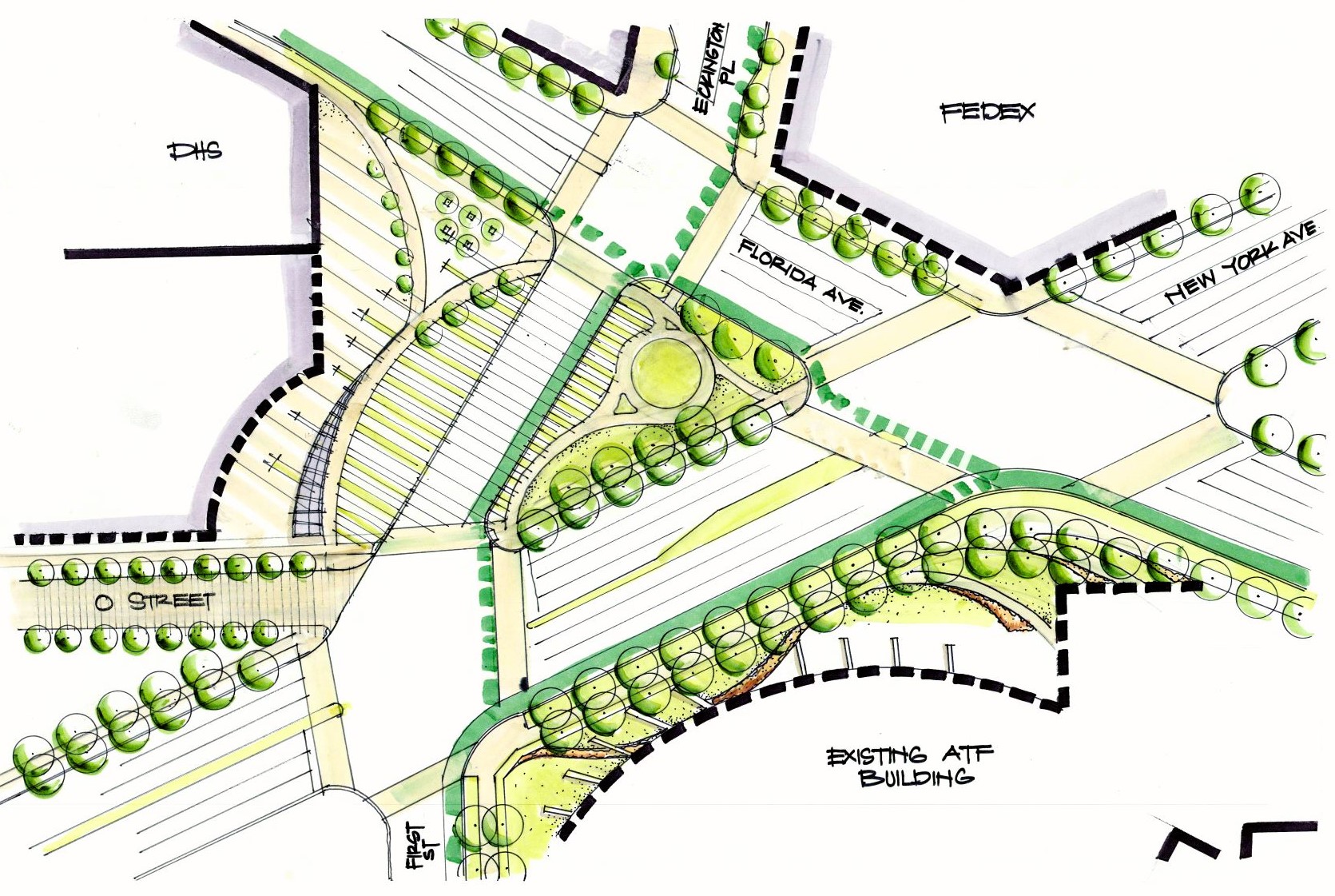
Image showing hand-sketched concept plan for active, passive and intermediate spaces and their programming in the three open spaces in study area.
Image source: ULI Washington.
Panelists grouped their analysis and recommendations under four categories: framing principles, neighborhood context and economic development, safety and connectivity, and open space design. The Panel noted that many successful hubs serve as a place of exchange (whether commercial, informational, or social) and improved linkages between the growing NoMa and Eckington communities are important objectives. They coined the term “Exchange” as an example of potential branding (particularly considering the “x” formed by New York and Florida Avenues). They also proposed next-steps and short-term priorities towards the progress of the design process.
On an end note, they stressed the importance of changing the perception of the Virtual Circle amongst various user groups, and the time to act is now. Jeff Marootian, the Director of DDOT endorsed the Panel’s thinking with regards to taking actions in the near future.
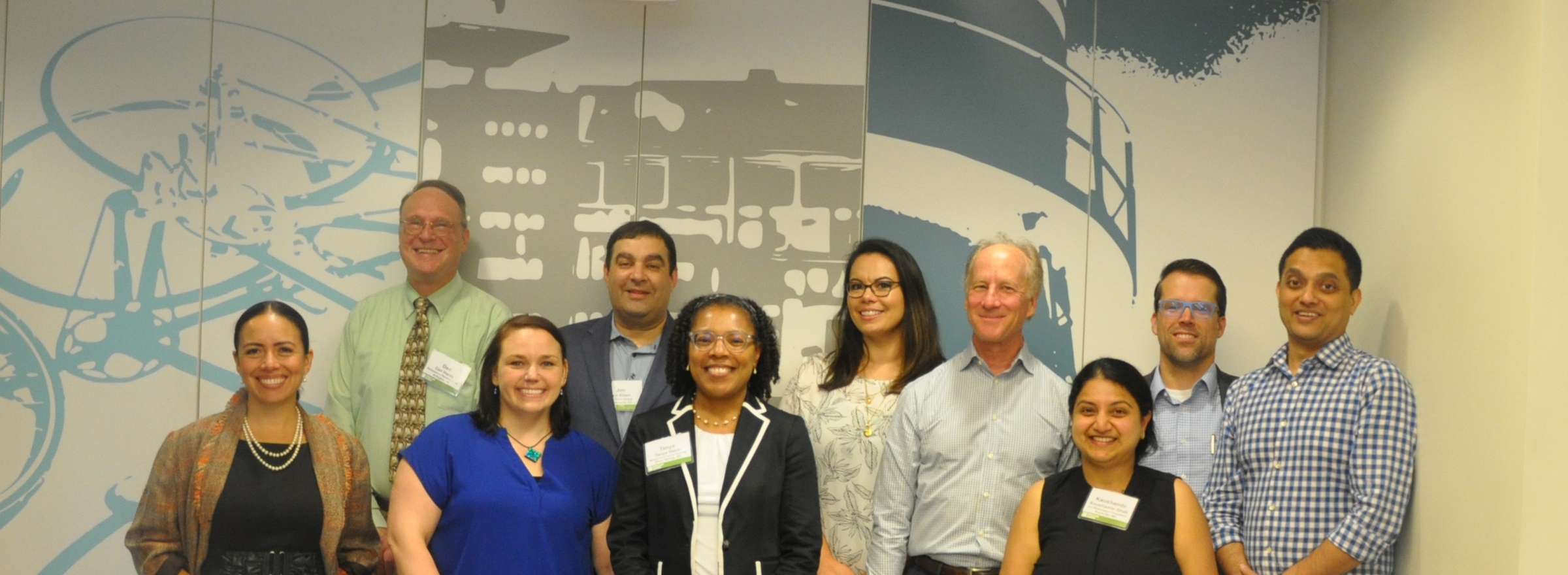
The TAP was chaired by Patrick L. Phillips, Former Global Chief Executive Officer, ULI. Members of the Panel included: Dan Hardy, Renaissance Planning Group; Dawn Volz, Dewberry; Jon Eisen, The Eisen Group; Paola Moya, Moya Design Partners; Rob Mandle, Crystal City Business Improvement District; Sukirti Ghosh, Rhodeside & Harwell; Suzie Battista, Fairfax County Department of Planning & Development; Tanya Stern, Montgomery County Planning Department and Kaushambi Shah, local Urban Designer.
A final version of the report may be found here

Photo showing the Virtual Circle intersection with the Wendy’s site at the center.
Photo By ULI Washington.

Image showing aerial map of existing conditions in the study area.
Photo By Sponsor briefing materials.

Photo showing regional traffic passing through New York Avenue NE, looking east.
Photo By ULI Washington.

Photo showing traffic along First Street NE and New York Avenue NE at the Virtual Circle
Photo By ULI Washington.

Photo showing multimodal user groups at the intersection of New York Avenue NE and Florida Avenue NE.
Photo By ULI Washington.

Image showing Virtual Circle Concept 6.
Photo By Sponsor briefing materials.

Sketch diagram showing analysis of elements of the L’Enfant Plan of Washington D.C. and the interpretation of triangles within the study area.
Photo By ULI Washington.

Image showing hand sketched concept plan for active, passive and intermediate spaces and their programming in the three open spaces in study area.
Photo By ULI Washington.

Technical Assistance Panel Team Photo